Share This Article
Sudbury residents will soon have a chance to see the oldest known comprehensive map depicting today’s boundaries. The map dates back to around 1795 and will be unveiled at an upcoming lecture hosted by the Sudbury Historical Society (SHS) on Thursday, October 23, 2025, at 6:30 PM at the Sudbury History Center and Museum.
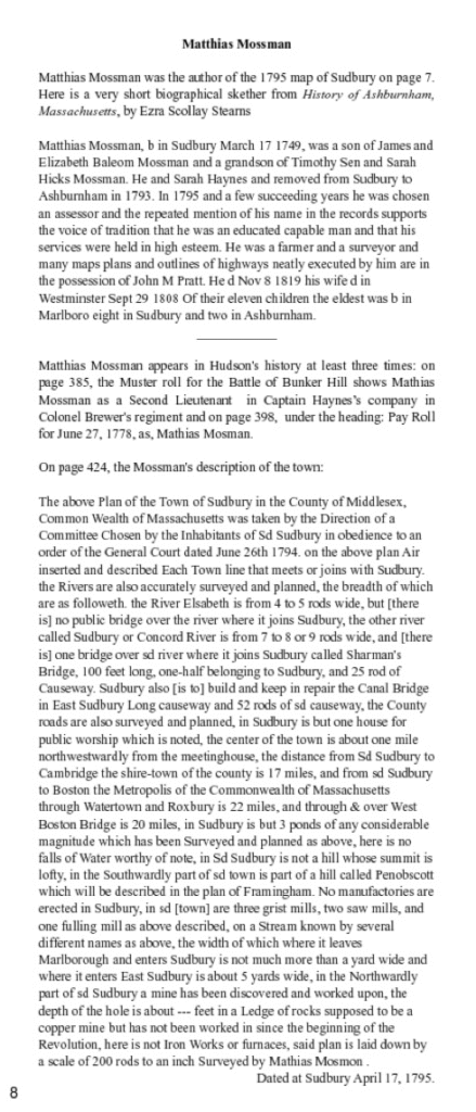
The map, created by Matthias Mossman (1749–1819), is believed to be the earliest surviving map to depict Sudbury’s boundaries as we recognize them today. It was recently acquired by the Historical Society and represents a major addition to the town’s historical record. You can access the online archive record here.

Town Historian Jan C. Hardenbergh will lead the presentation, titled “Sudbury Treasure Map,” exploring the map’s origins, historical context, and the story of its maker. According to Hardenbergh’s book, Mossman, a Sudbury native, was known as an educated person and capable surveyor, serving as both a farmer and a surveyor in the late 18th century. His meticulous records captured not only Sudbury’s early geography but also its bridges, mills, and roads as they existed just after the American Revolution. The relevant page from the book is embedded below.
In preparation for the lecture, SHS Director and Archivist Francesco Buccella, along with local high school interns Gaiyatri Mathew and Marin Raniere, fully transcribed the map.
The Historical Society hopes to raise $4,000 to restore and preserve the map so it can be displayed and studied for generations to come. Donations can be made through the SHS website at sudbury01776.org.
The lecture is part of the SHS’s “Sudbury’s Changing Landscape” series, funded by the Mass Cultural Council. Admission is free, but space is limited. Advance registration is available via Eventbrite.